May 1, 2019 NWACA Annual Meeting presentations, covering the events of the past year, the role of the Travis County Constable, how to minimize the impact of wildfire, caring for oak trees, recycling, 4th of July plans, and Loop 360 improvement projects.
NFPA Fact Sheet – Eaves
This fact sheet from the National Fire Protection Association gives guidance for ways to ensure that the area under eaves is well-constructed and prevents ember intrusion during wildfire.
NFPA Fact Sheet – Skylights
This fact sheet from the National Fire Protection Association gives guidance on how to prevent skylights from being an entry point for embers during wildfire.
NFPA Fact Sheet – Roofs
This fact sheet from the National Fire Protection Association describes ways to reduce the risks to roofs during wildfire.
NFPA Fact Sheet – Exterior Sprinklers
This fact sheet from the National Fire Protection Association describes the use of exterior sprinklers to minimize the possibility of home ignition, but warns that other methods are probably more practical.
NFPA Fact Sheet – Decks
This fact sheet from the National Fire Protection Association gives guidance for how to make decks wildfire resistant.
NFPA Fact Sheet – Ember Ignited Decks
This fact sheet from the National Fire Protection Association describes the risks to decks from embers and how to mitigate those risks.
NFPA Fact Sheet – Fences
This fact sheet from the National Fire Protection Association describes best approaches for fencing and gives guidance on maintaining them.
NFPA Fact Sheet – Coatings
This fact sheet from the National Fire Protection Association describes common practices and limitations of surface coatings for wildfire resistance.
NFPA Fact Sheet – Attics and Crawl Spaces
This fact sheet from the National Fire Protection Association describes best practices for how to make attics and crawl spaces wildfire resistant.
Austin – Coexisting with Coyotes
A brochure from the City of Austin describing the habits of coyotes, how to haze them, and when to report their activities to 3-1-1
1 – Final Documents Regarding Austin Oaks
An extensive page is available with the documentation from the charrette that was held in January 2016 for Austin Oaks. The page also includes material from the work done after the charrette during 2016 and 2017, culminating in the final PUD ordinance with the City of Austin, which was made effective April 24, 2017.
2018 05 08 Annual Meeting – Julie Cowan slides
Our AISD School Board Trustee gave a talk about our schools and how taxes are handled.
2018 05 09 Annual Meeting Handout
This handout was provided to each attendee at the 2018 Annual Meeting.
2018 05 09 Annual Meeting Slides
These slides were used by the speakers at the 2018 Annual Neighborhood meeting.
2018 Neighborhood Watch Presentation
This presentation was given by Officer Darrell Grayson at the March 26, 2018 meeting about Neighborhood Watch. It contains many helpful ideas about keeping the neighborhood safe.
NWACA Community Wildfire Protection Plan (CWPP)
This document describes the approach being taken by NWACA to address the wildfire risks that were identified in the February 2014 NWACA assessment. Individual neighborhood groups use this as a basis and as background for creating their own neighborhood-local CWPP.
NWACA Area Community Wildfire Assessment Report Introduction
This document explains the background for the NWACA Area Community Wildfire Assessment and how that assessment is to be used by individual communities within NWACA as they build Firewise Plans.
Firewise Activity and Expense Tracking Form
Form that can be used by Firewise Communities to track their time and expenses for hardening their homes and landscapes
NWACA Area Community Wildfire Assessment Report
The report completed by the Austin Fire Department and Texas Forest Service, which provides the baseline wildfire assessment for the NWACA area. This can be used as a reference for any smaller portion of NWACA when putting together their Firewise Community applications and their CWPP (Community Wildfire Protection Plan).
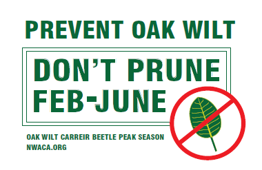
 Until July, sap beetles are attracted to fresh tree wounds and can transmit the oak wilt fungus to a healthy oak tree during pruning. The heat of July-August is believed to suppress the beetles and reduce the risk of infection. Note that all trees are under the normal stress of summer, depending on soil moisture, and some are still in their growing season then. So if you haven’t completed pruning of oaks by now, it’s best to wait until fall.